
http://www.mmdtkw.org/EGtkw0101TutFlash.jpg
Instructor TKW inserted in the funerary mask if King Tutankhamun
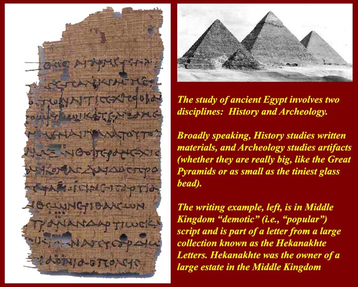
http://www.mmdtkw.org/EGtkw0102HistoryArcheology.jpg
History and Archeology are both necessary for the study of ancient Egypt.
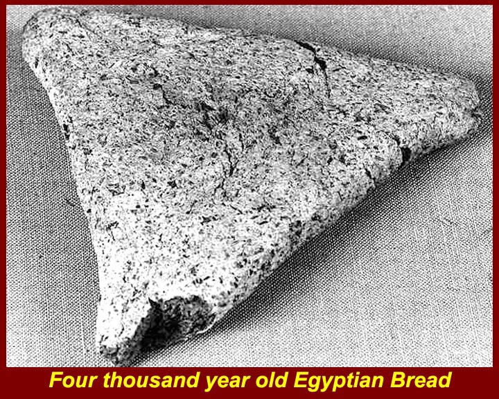
http://www.mmdtkw.org/EGtkw0103-4000YrOldBread.jpg
Archeology studies "artifacts", and that includes things other than stone and metal. In Egyptian desert conditions that can include normaly perishable items such as bread and people.
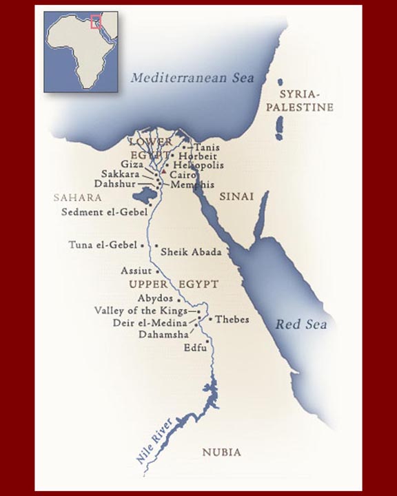
http://www.mmdtkw.org/EGtkw0104EgyptMap.jpg
Dynastic Egypt as well as modern Egypt is essentially the Nile River Valley. The rest was and is dessert with a few widely scattered oases. As we shall see, however, there were periods in pre-history when the monsoon pattern shifted, and much of the desert was well watered. The most recent of these periods was in the late paleolithic and early mesolithic (9500 to 4500 BC) when vast areas of Egypt's Eastern and Western Deserts teemed with fauna now present only in sub-Saharan Africa.
 cay
and
cay
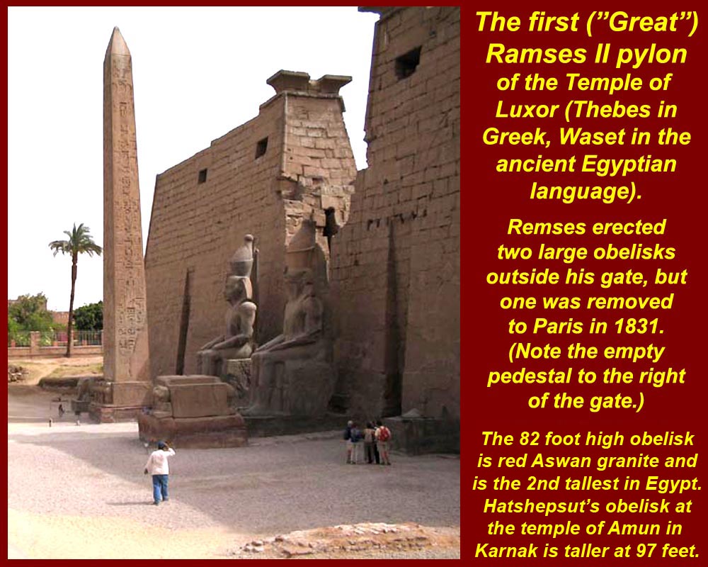
andhttp://www.mmdtkw.org/EGtkw0105CleoNeedleParis2.jpg
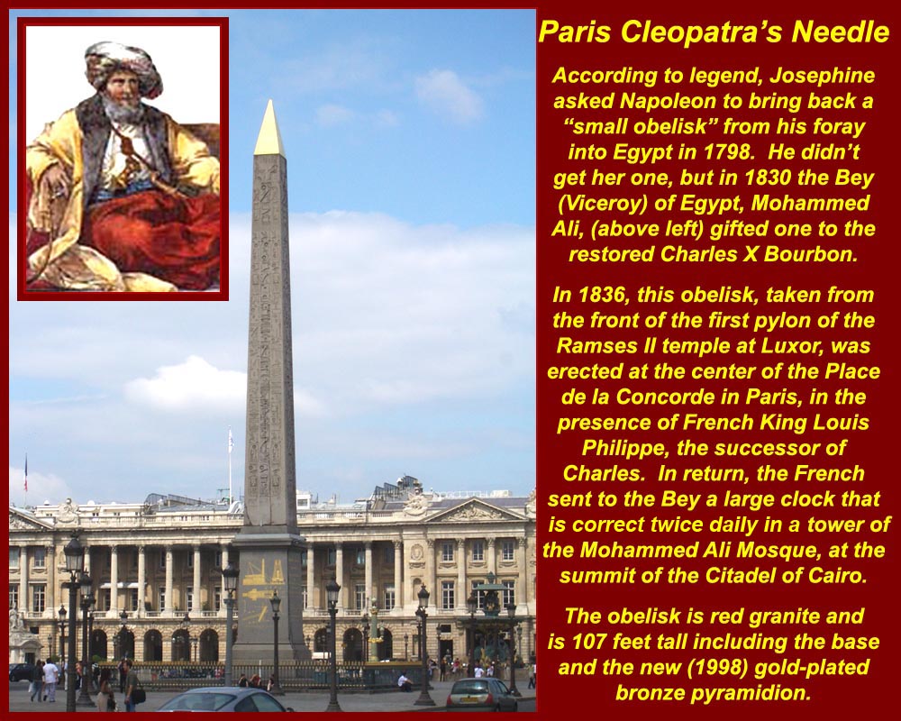
Egyptian monumental architecture has fascinated the outside world since ancient times. Every foreign conqueror or tourist wamted to take home his or her own Egyptian monument. This, of course left some gaps in Egypt's own landscape. Where once there were two obelisks in front of the First Pylon (of Ramses II) in Luxor, now there is only one. Its mate is in Paris.
http://www.mmdtkw.org/EGtkw0106CleoNeedleParis1.jpg
That missing Luxor obelisk now stands in the center of the Place de la Concorde.
Bey Mohammed Ali of Egypt traded it for a large clock. Neither French nor Egyptian engineers have ever been able to make the clock work. It still stands unworking at the Mohammed Ali mosque in Cairo's citadel.
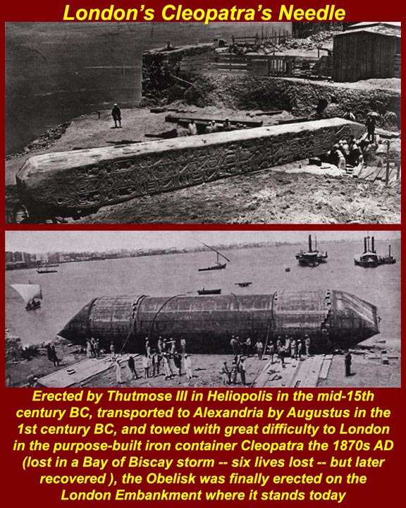
http://www.mmdtkw.org/EGtkw0107CleoNeedleLondon1.jpg
London got its obelisk from Alexandria and then almost lost it at sea when its specially built floating container broke lose from its tow boat in a storm. It was recovered in the Bay of Biscay.
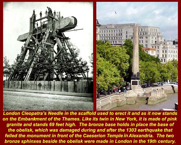
http://www.mmdtkw.org/EGtkw0108CleoNeedleLondon2.jpg
After a perilous recovery effort, the Brits erected their obelisk on the Thames Embankment in August of 1879.
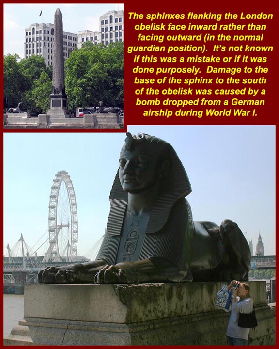
http://www.mmdtkw.org/EGtkw0109CleoNeedleLondon3.jpg
The London obelisk is flanked by two British-made bronze sphinxes, one of which was damaged by a bomb dropped on London from a German airship during WWI. The sphinxes are mounted to look inward toward the obelisk rather than in the Egyptian manner, looking outward as guards. Nobody seems to know whether this was a mistake or if it was intentional.
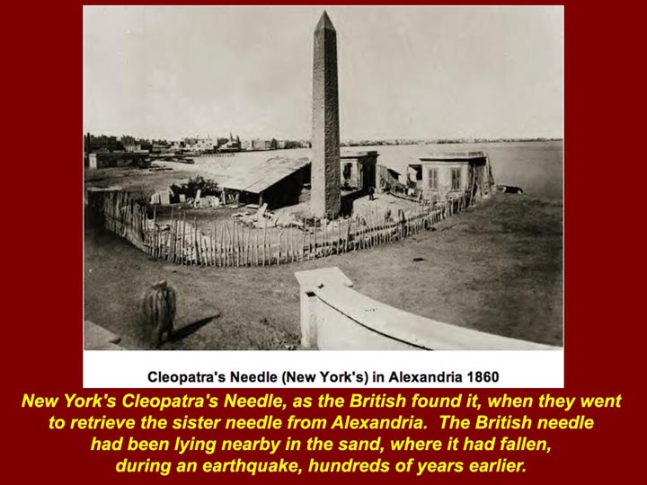
http://www.mmdtkw.org/EGtkw0110CleoNeedleNY2.jpg
New York's obelisk also came from Alexandria and it was the mate of the one that now stands in London.
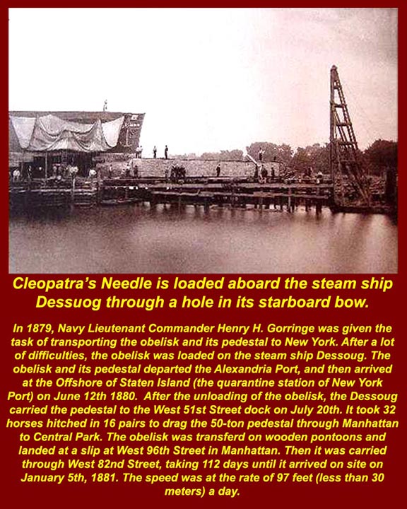
http://www.mmdtkw.org/EGtkw0111CleoNeedleNY3.jpg
Rather than building a capsule to transport the NY obelisk, the US navy just cut a hole in the side of a transport ship, slid the obelisk in, and then patched up the hole. When the ship arrived in New York, the process was reversed.
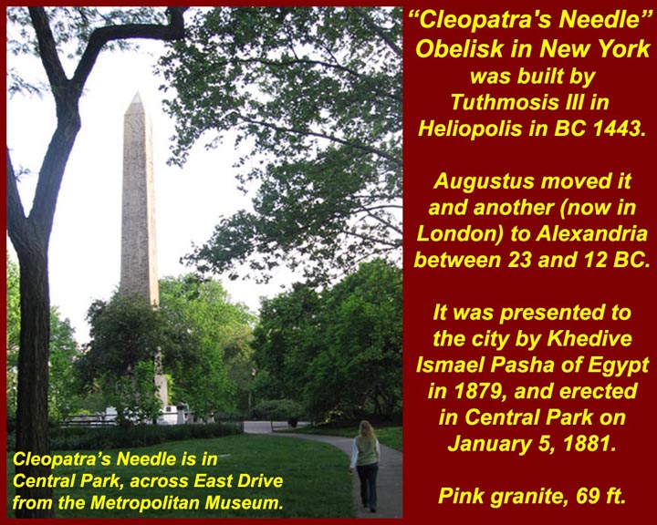
http://www.mmdtkw.org/EGtkw0112CleoNeedleNY1.jpg
The NY obelisk was erected in Central Park in 1879 where it still stands, across East Drive from the Metropolitan Museum. The Three obelisks in Paris, London, and Rome are all known as "Cleopatra's needles". For more information on the "needles" go to http://en.wikipedia.org/wiki/Cleopatra's_Needle. (But always remember that "Wikipedia" can be edited by anyone: although this entry seems accurate, others might have to be taken "Cum grano salis".)
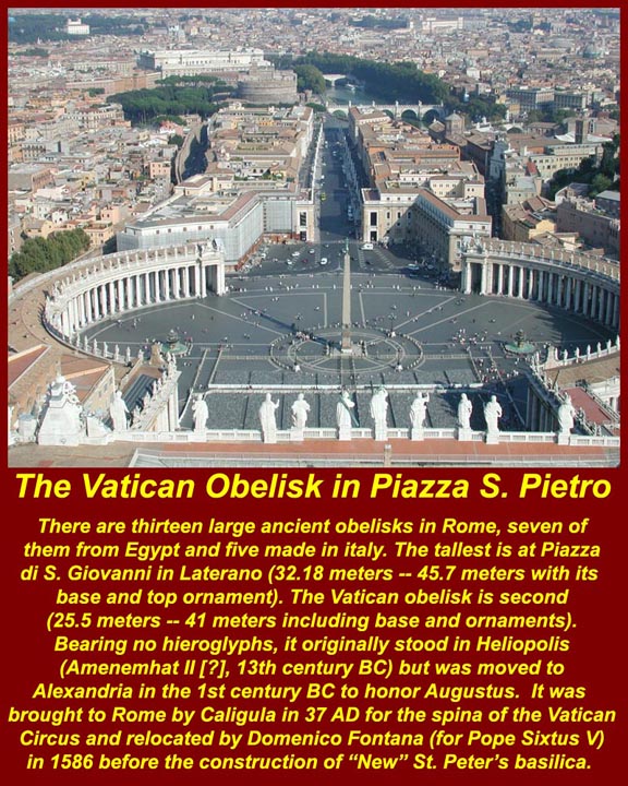
http://www.mmdtkw.org/EGtkw0113CleoNeedleRome.jpg
There are thirty known Egyptian obelisks in the world, and 13 of them are in Rome (7 from Ancient Egypt, one made in Egypt for Emperor Domitian, and one made for the Medici when they shipped a "Roman" obelisk back to their Pitti Palace gardens in Florence -- the other four were probably made in Italy in ancient times, although the stone may have come from Egypt.) There are only seven left in Egypt, unless there are some hidden in the sands. The reason Rome has so many obelisks is that the ancient Romans shipped them back to Rome after conquering Egypt (Anthony, Cleopatra, and all that). Istanbul also has one that was shipped there from Egypt by the Eastern Roman Emperor Theodosius. The ancient Romans put obelisks to various uses -- mostly decorative in the center of horse-race tracks, but one was used also as the gnomon or style of a giant sundial erected by Augustus on Rome's Campus Martius. Several were even put to a legitimate Egyptian religious use in front of a Temple of Isis, also on the Campus Martius. Almost all of the "Roman" obelisks eventually fell, but most were moved around and re-erected by Pope Sixtus V (Pope from 1585 to 1590) at the ends of long avenues connecting Rome's "pilgrimage churches". One stood for centuries next to Constantine's old basilica of St. Peter, but Sixtus V moved to its present site in 1586, shortly before the "new" St. Peter's basilica was built. The image shows that same obelisk where it stands in the square in front to St. Peter's basilica in the Vatican (as seen from the cupola of the basilica dome). More information on the world's Egyptian obelisks is available at http://egipto.com/obeliscos/obeliskindex.html
http://www.mmdtkw.org/EGtkw0114CleoNeedleWashington.jpg
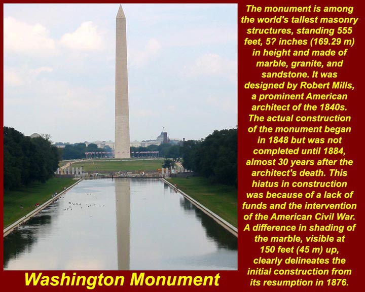
The world's tallest obelisk and the world's tallest free-standing unreinforced stone structure (555 feet = a bit more than 169 meters), is the Washington Monument in Washington DC. Interestingly, the next biggest obelisk anywhere is also in the US: it's the Jefferson Davis Monument in Fairview Kentucky, near where Davis was born -- 351 feet (107 meters) of poured concrete.

http://www.mmdtkw.org/EGtkw0115aArlingtonPyramid.jpg
Arlington County, VA, lacks a monumental obelisk, but pyramid-shaped rooftops cover several large building in the Metro corridor. The biggest seems to be on the triangular US Government building bounded by Washington Boulevard, Clarendon Boulevard, and North Highland Street. The building also has three corner turrets, which are another unfortunate signature of Arlington's faux architecture.
http://www.mmdtkw.org/EGtkw0115bHerodotus.jpg
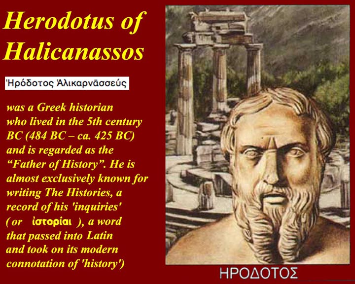
Herodotos of Halicarnassus wrote about his travels in Egypt in the 5th century BC and thus became the first known foreign Egyptologist. Like many of his successors he got some things right and many things wrong.
http://www.mmdtkw.org/EGtkw0116NeroAugustus.jpg
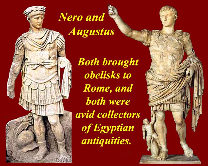
The kindest description would be "collectors", but by modern standards they were looters of Egypt, unmatched until Mussolini stole yet another obelisk from Aksum Ethiopia in 1937. See http://www.google.com/search?q=aksum+obelisk for information on the return of the obelisk to Aksum 68 years later (2005).
http://www.mmdtkw.org/EGtkw0117aNapoleon.jpg
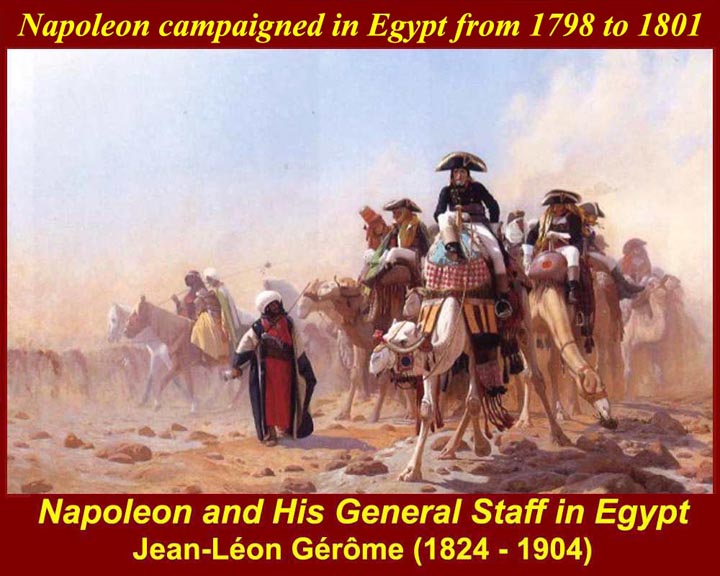
Napoleon took hundreds of scientists and experts with him when he conquered and held Egypt from 1798 to 1801. That didn't prevent him from looting the country. In fact, he left behind a corrupt Consulate that continued to bribe local officials for many years after his departure so that France could have first pick of newly discovered antiquities. The French conquest popularized Egypt in Europe, and hoards of European looters flowed in to compete with France.
http://www.mmdtkw.org/EGtkw0117bNapoleonDescription2.jpg
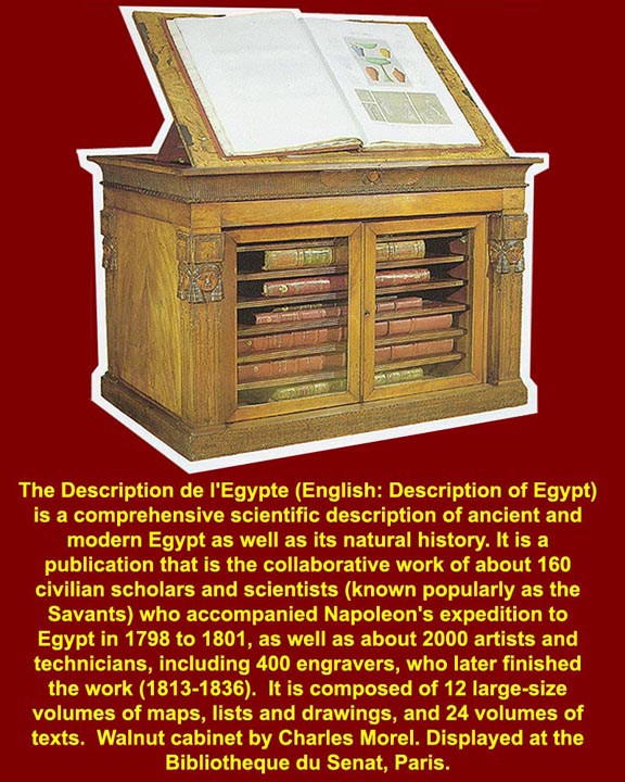
French interest in things Egyptian continued even after the 1815 Congress of Vienna and the restoration of the French monarchy. Napoleon's scholars and engravers finally completed his grand academic project Description de l'Egypte in 1828 (final drawings in 1836). The multi volume set is still an extremely valuable resource to Egyptologists, particularly since so much of the paint work drawn by Napoleon's artists has faded during intervening years. For more on Napoleon's expedition, see http://www.touregypt.net/featurestories/description.htm. The whole of the French text and all of the plates of the Description de l"Egypt is now available on the internet at http://descegy.bibalex.org/index1.html courtesy of the new Bibliotheca Alexandrina (http://www.bibalex.org/Home).
http://www.mmdtkw.org/EGtkw0118Champollion.jpg
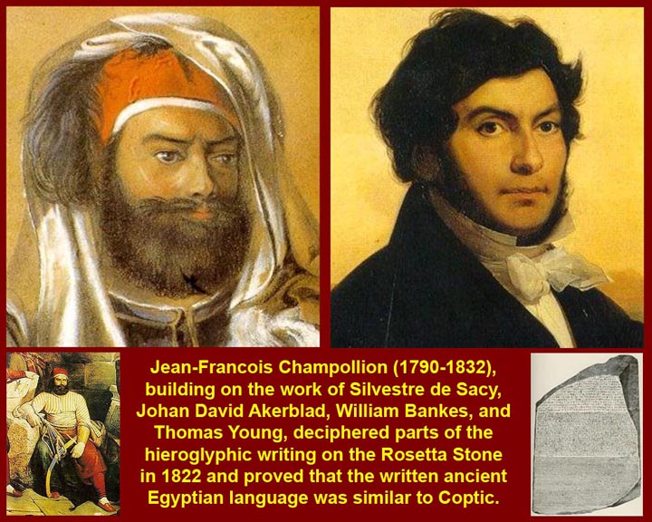
During Napoleon's Egyptian sojourn, his troops found at Rosetta the trilingual stone that unlocked hieroglyphic writing (at least to European/Western eyes). Building on the work of others, Jean-Francois Champllion deciphered parts of the Rosetta Stone in 1822 and proved its similarity to Coptic. Some modern Egyptian scholars disparage the work of Champllion and other Europeans saying that Arabs/Egyptians could have told the Europeans everything the Europeans had "discovered" if the Europeans only had the wit to ask.
http://www.mmdtkw.org/EGtkw0119BelzoniPortraits.jpg
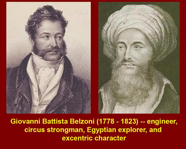
GianBattista Belzoni, an Italian circus strongman, adventurer, and eventually a semi-legitimate archeologist, worked for the British Museum, but a corrupt British Consul diverted many of his finds into private hands. Belzoni believed in brute force methods whether dealing with competitors or with Egyptian tombs (he liked battering rams), but he also made very important discoveries in the Valley of the Kings where he was the first European excavator and at Abu Simbel where he excavated the temples of Ramesses II and his wife. He also is credited with being the first modern European to enter the burial chamber of the Great Pyramid at Giza. A short biography of Belzoni is available at http://www.touregypt.net/featurestories/belzoni.htm and the full text (English, with all illustrations) of his own book about his explorations and discoveries is at http://gallica.bnf.fr/ark:/12148/bpt6k1053464.pagination

http://www.mmdtkw.org/EGtkw0120AmeliaEdwards.jpg
Amelia Edwards was the first of the great female Middle-East Archeologists. She had made a fortune as a novelist before she became interested in Egypt, and used that fortune to fund Egyptian explorations. Her bequest to Unuversity College, London, set up the Edwards Chair of Egyptian Archaeology and Philology. Flinders Petrie was the first Edwards Professor. A short bio of Edwards is at http://www.brown.edu/Research/Breaking_Ground/bios/Edwards_
Amelia%20Blanford.pdf and her book, A Thousand Miles up the Nile is on the Internet is several formats (including audiobook) at http://librivox.org/a-thousand-miles-up-the-nile-by-amelia-edwards/
http://www.mmdtkw.org/EGtkw0121FlindersPetrie.jpg
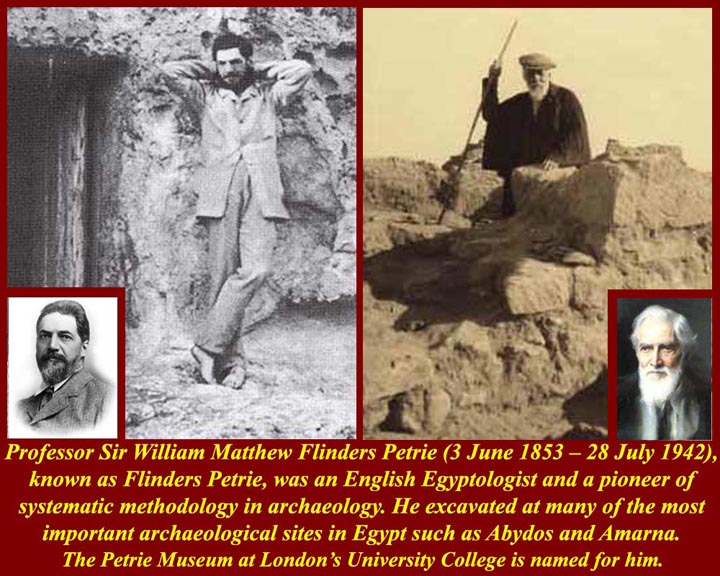
Sir William Matthew Flinders Petrie is the father of modern scientific Egyptology. His innovations include the development of historical chronology based on differing styles of pottery and meticulous field practices. His work was especially important in establishing Egyptian prehistory and pre-dynastic and early dynastic archeolgy. His basic chronology of earliest Egypt is still the basis of current research. A Petrie bio is at http://en.wikipedia.org/wiki/William_Matthew_Flinders_Petrie
Artifacts collected and catalogued by Petrie formed the basis for the Petrie Museum at University College, London (http://www.petrie.ucl.ac.uk/index.html).
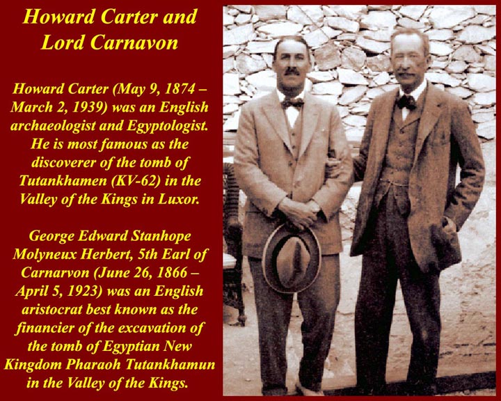
http://www.mmdtkw.org/EGtkw0122CarterCarnarvon.jpg
Howard Carter's search for the tomb of Pharaoh Tutankhamun was funded by Lord Carnarvon. A short bio of Carter and an account of his discovery of Tut's tomb is at http://www.answers.com/topic/howard-carter. A Google search for Tutankhamun turned up almost 900 thousand internet locations -- more than you ever wanted to know. (The Steve Martin King Tut song is at http://www.nbc.com/saturday-night-live/video/king-tut/976141/.)

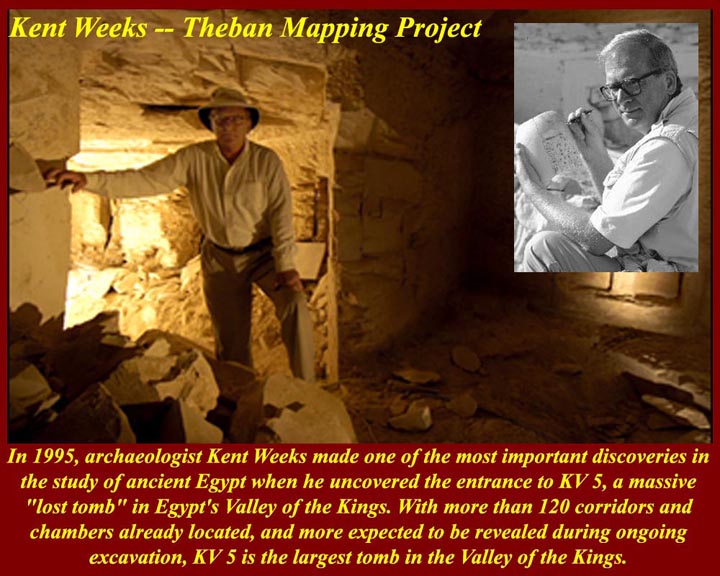
http://www.mmdtkw.org/EGtkw0123KentWeeks.jpg
American archeologist Kent Weeks heads the Theban Mapping Project (the area around the Valley of the Kings, Luxor) and is the leader of the ongoing excavation of KV5, the tomb of the sons of Rameses II in the Valley of the Kings (http://www.thebanmappingproject.com/sites/browse_tomb_819.html). The Theban Mapping Project's main Internet site is at http://www.thebanmappingproject.com.
For a January 2007 account of the history and geophysics of the Valley of the Kings, see http://www.geotimes.org/jan07/feature_ValleyKings.html.
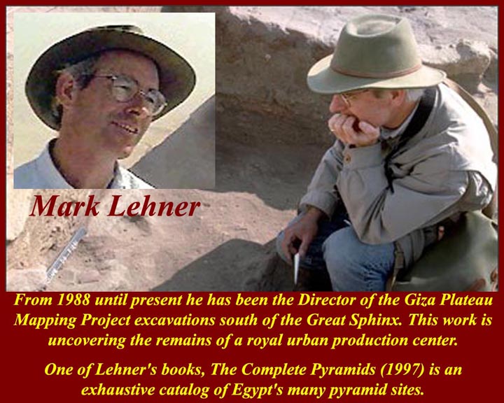
http://www.mmdtkw.org/EGtkw0124MarkLehner.jpg
Mark Lehner is another american Archeologist who heads the Giza Plateau Mapping Project (the area around the Great Pyramids and the Sphinx). Lehner is also the President of Ancient Egypt Research Associates, Inc. (AERA) which is the American non-profit that funds most of his research. The AERA internet site, which is the best source of information on the ongoing Giza plateau research, is at http://www.aeraweb.org/, and the portal to Aera projects on the plareau is at http://www.aeraweb.org/projects/.
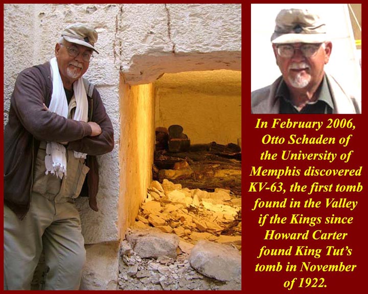
http://www.mmdtkw.org/EGtkw0125OttoSchadenKV63.jpg
In December of 2005, American Archeologis Otto Schaden found KV63, the tirst tomb found in the Valley of the Kings since Howard Carter found Tut's tomb (KV62) in 1922. The KV63 web site is at http://www.kv-63.com/. Scientists have detected another possible tomb near KV63 with ground-penetrating radar, but that site has not yet been excavated. It has tentatively been given the designation KV64(?). The question mark will be removed after excavation. Find information about KV64(?) at http://ancienthistory.about.com/b/a/257779.htm.
http://www.mmdtkw.org/EGtkw0126ZahiHawass.jpg
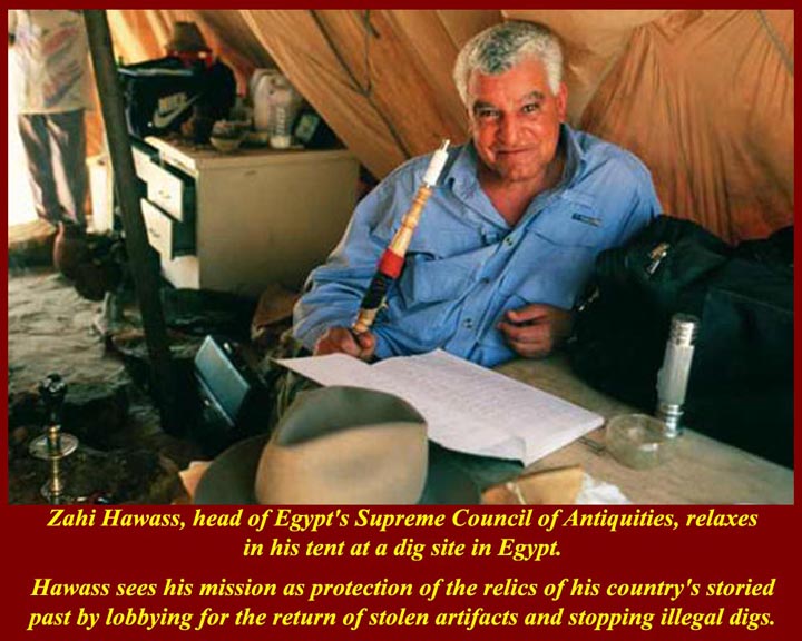
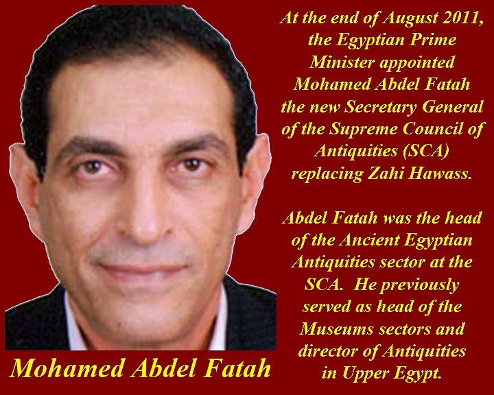
What can we say about Zahi Hawass? Until recently he was head of Egypt's Supreme Council of Antiquities (SCA) and, for a short time, Minister of Antiquities. He was long considered to be the best thing that happened to Egyptian Archeology since the first Pharaoh put on his crown. Dr. Hawass was the most influential archaeologist in Egypt, responsible for supervising his own excavations as well as the work of foreign expeditions to all of the sites under his jurisdiction. He received his PhD from the University of Pennsylvania, and he taught at the University of California in Los Angeles, Cairo University, and the American University in Cairo. He was said to be intolerant of views and archeological theories contrary to his own. His alleged views and his links to business ventures and to foreign organizations (like the US National Geographic Society) and to the Mubarak regime led to his replacement by Dr. Mohamed abd el Sharraf, the former head of the Egyptian Antiquities Section of the SCA.

http://www.mmdtkw.org/EGtkw0127RickO'ConnellMummy.jpg
"Everything I know about Egypt, I learned at the movies". If the pix of Brendan Fraser as hero-archeologist (actually as an ex-Foreign Legion soldier of fortune) doesn't do anything for the guys, they can go to http://web.tiscali.it/anakina/an1.jpg to see the villainess of the recent Mummy movies.
http://www.mmdtkw.org/EGtkw0128AncEGYChron.jpg
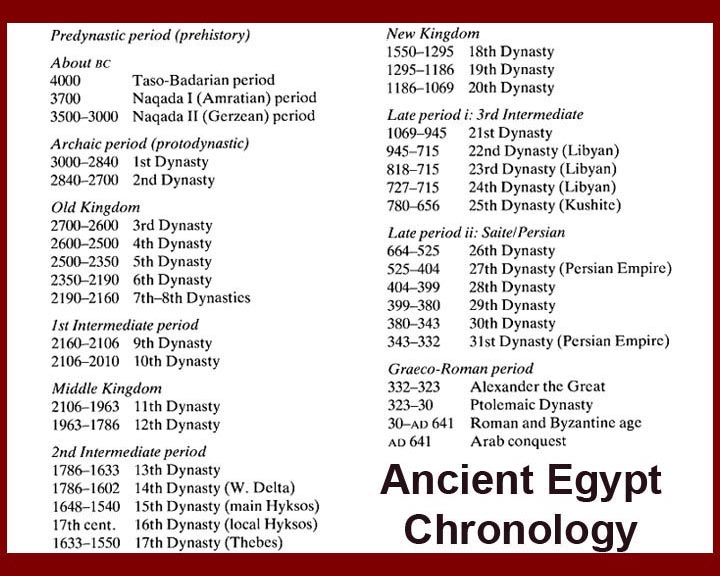
Major periods of ancient Egyptian history.
http://www.mmdtkw.org/EGtkw0128bSiwaFootprint.jpg
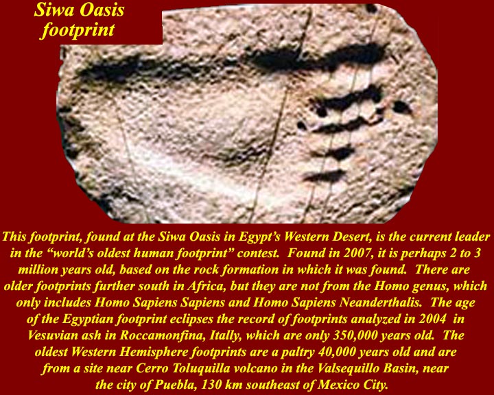
A human (i.e., genus Homo) footprint found in August 2007 at the Siwa Oasis in Egypt's Western Desert is said to be 2 to 3 million years old based on the rock formation in which it was found. Other dating methods will be used to verify its age. The earliest previously found footprint in Roccamonfina, Italy, Vesuvian ash is 350 thousand years old. The oldest Western Hemisphere footprint, from Vallsequillo Basin near Puebla, Mexico, is said to be 40,000 years old, but that's old enough to change how we think the earliest folks got to the Americas.
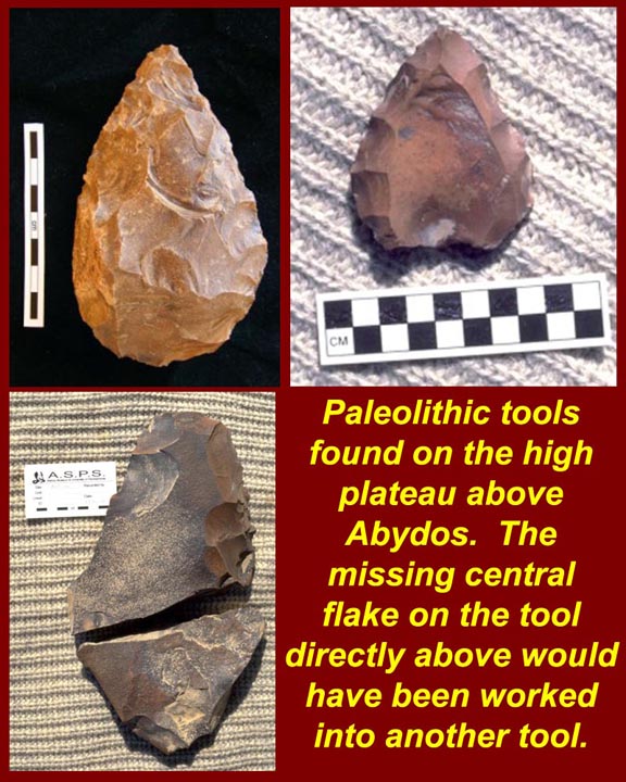
http://www.mmdtkw.org/EGtkw0129AbydosPaleoTools.jpg
Old Stone age tools from Abydos.
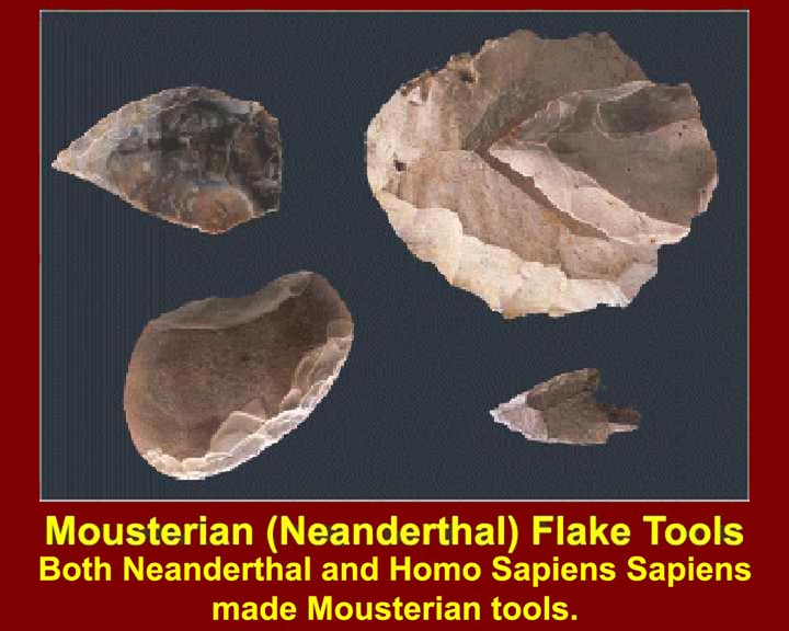
http://www.mmdtkw.org/EGtkw0130MousterianToolsA.jpg
Neanderthals and Homo Sapiens Sapiens made essentially the same kind of tools in eastern North Africa.
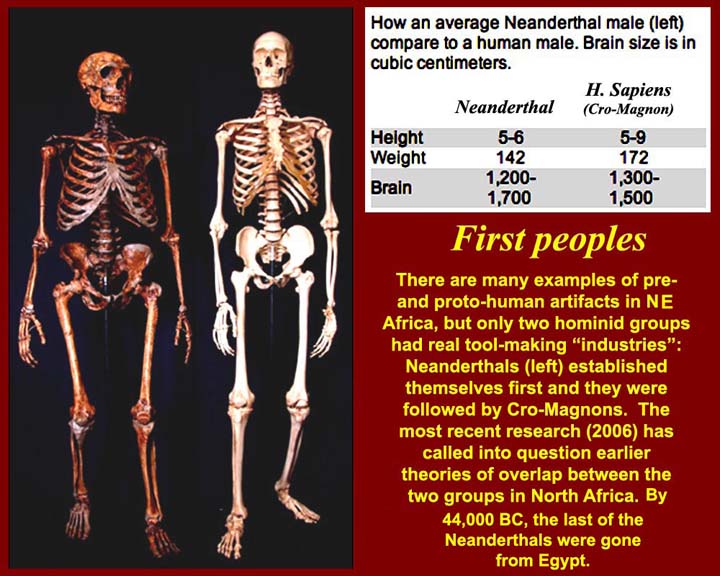
http://www.mmdtkw.org/EGtkw0131SkeletalComparison.jpg
Skeletal comparison between H. Neanderthalis and H.Sapiens Sapiens
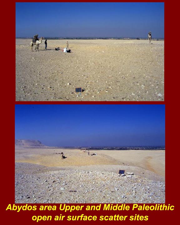
http://www.mmdtkw.org/EGtkw0132AbydosSurfaceScatter.jpg
In sandy desert areas, archeologist often find "surface scatter". Artifacts and remains that may have been deposited in different soil layers are all found on the same surface level because the soil between artifact layers has blown away. In some areas (e.g., around some dry lake beds in the Saudia Arabian Rub' al Khali and some sites along the Saudi border with the United Arab Emirates), surfaces might be completely covered in artifacts, but artifacts are more widely scattered on Egyptian surfaces. Wherever they occur, surface scatter lithics are mostly only broadly classifiable by typology. This photo and several others used in this "old stona age" section of this page are from the Internet site of the Abydos Survey for Paleolithic Sites: http://www.oldstoneage.com/abydos/.
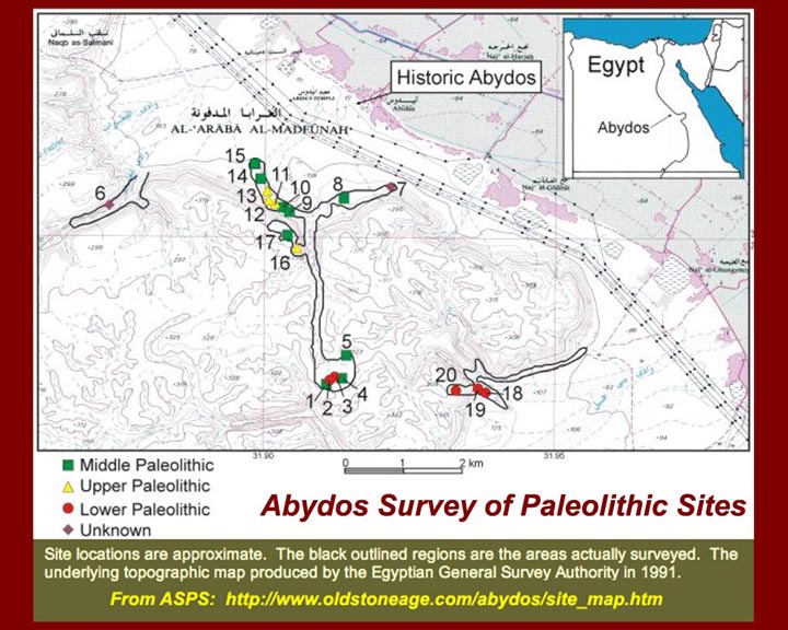
http://www.mmdtkw.org/EGtkw0133AbydosPaleoSites.jpg
A map of paleolithic ("old stone age") sites around Abydos.
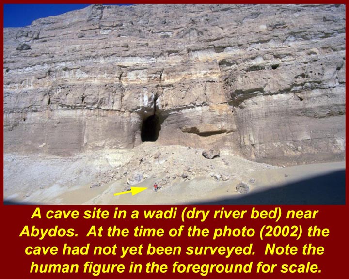
http://www.mmdtkw.org/EGtkw0134AbydosCavesite.jpg
A cave site near Abydos. Yes, some paleolithic inhabitants of the Egyptian High Desert were cave men. At the time of this photo (2002), this cave had not yet been explored. In the foreground, near the bottom of the picture is a tiny-looking human figure to provide scale.
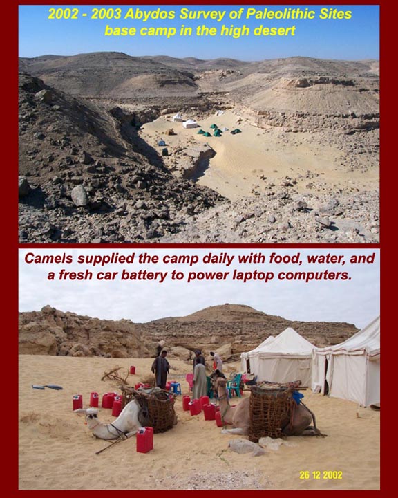
http://www.mmdtkw.org/EGtkw0135AbydosBaseCamp.jpg
Abydos Survey for Paleolithic Sites 2002 base camp.
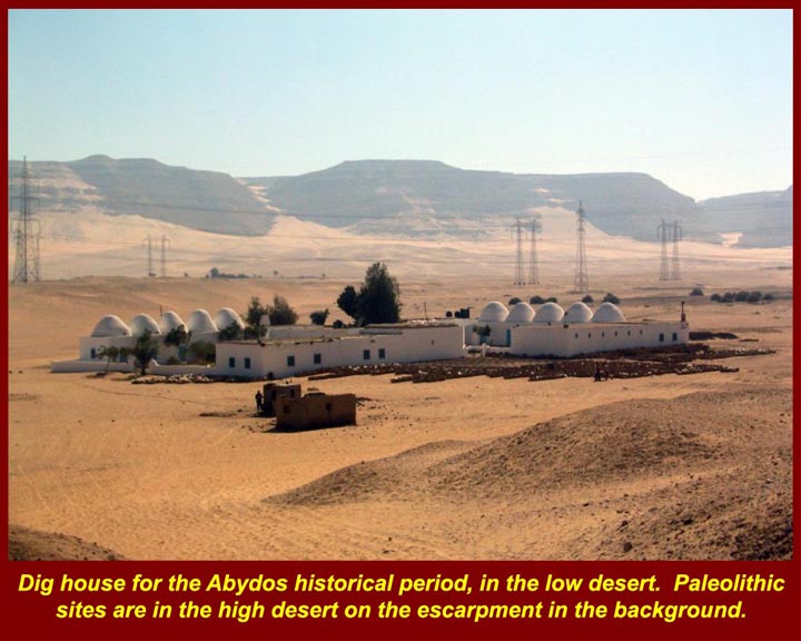
http://www.mmdtkw.org/EGtkw0136AbydosDigHouse.jpg
The Abydos Dig House.
http://www.mmdtkw.org/EGtkw0137Petrie1PaleoTools.jpg
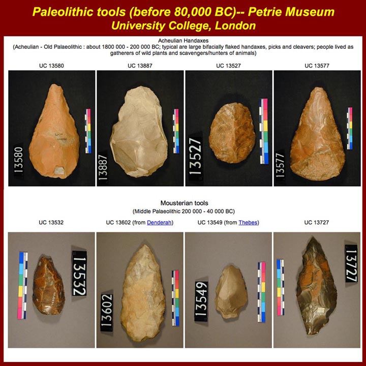
Paleolithic pints from the Petrie Museum, University College London.
http://www.mmdtkw.org/EGtkw0138GilfKebir.jpg
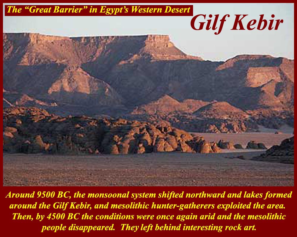
In paleolithic and moesolithic times this area was heavily watered. Early humans hunted (and later herded) in this area and left painted images of their activities along with artifacts.
http://www.mmdtkw.org/EGtkw0139GilfKebirMap.jpg
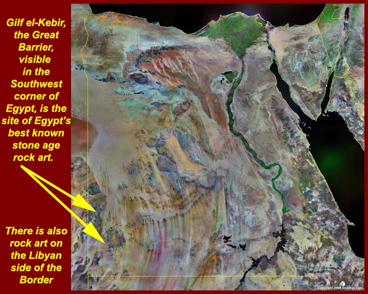
A satellite image shows the location of the Great Barrier (Arabic = Gilf Kebir).
http://www.mmdtkw.org/EGtkw0140RockArt2.jpg
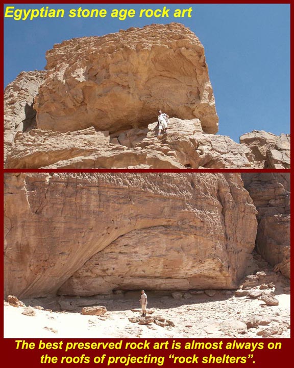
Great Barrier rock art is usually found on overhanging rock surfaces. There once may have been much more on surfaces more exposed to weather.
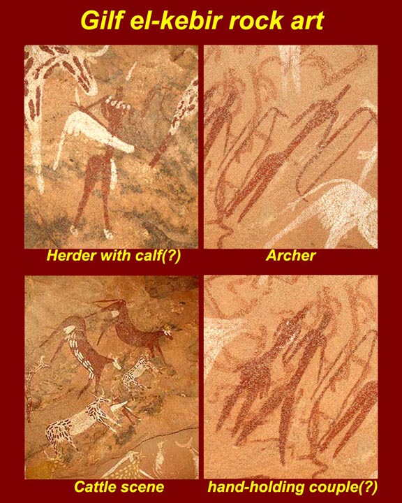
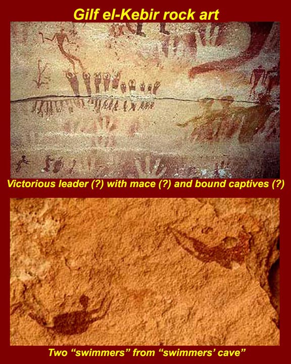
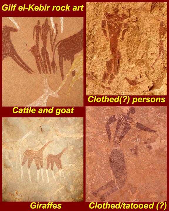
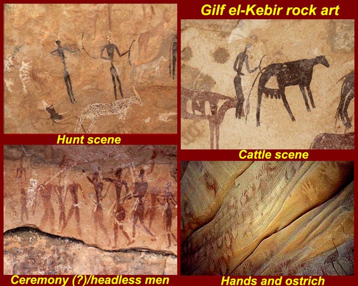
http://www.mmdtkw.org/EGtkw0141RockArt3.jpg
http://www.mmdtkw.org/EGtkw0142RockArt4.jpg
http://www.mmdtkw.org/EGtkw0144RockArt6.jpg
http://www.mmdtkw.org/EGtkw0143RockArt5.jpg
Examples of Great Barrier rock art. Note that the bottom half of the second image is interpreted as showing people swimming, which is not something that could happen with today's desert conditions.
http://www.mmdtkw.org/EGtkw0145Petrie2MesolithMicroAndPoints.jpg
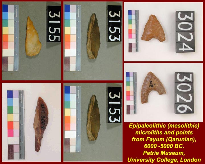
Mesolithic microliths and points.
http://www.mmdtkw.org/EGtkw0146DecimalFlintPetrie.jpg
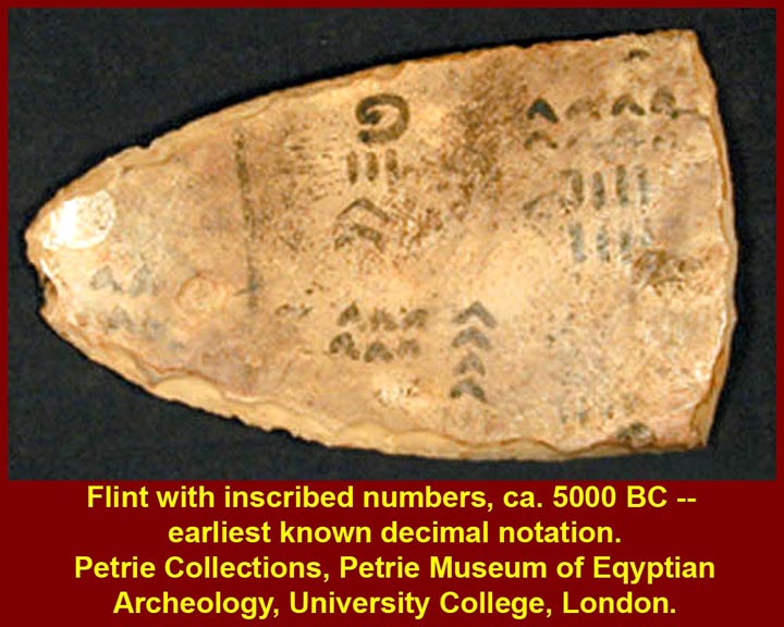
The first known use of decimal notation -- numbers written on a mesolithic flint blade, about 5000 BC.
http://www.mmdtkw.org/EGtkw0147MesolithicNaqadaIIConcubines.jpg
http://www.mmdtkw.org/EGtkw0148BadarianIvoryWoman.jpg
http://www.mmdtkw.org/EGtkw0149IvoryConcubine.jpg
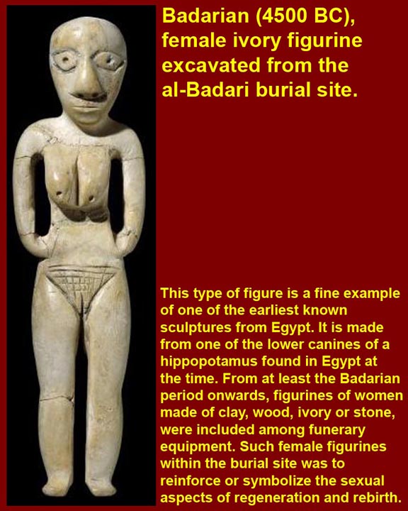
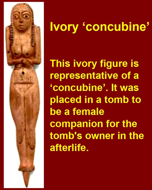
Small carved ivory, stone, and clay female images were sometimes included in mesolithic and neolithic Egyptian graves to accompany the male deceased and, perhaps, by sympathetic magic, to provide for his sexual desires. These are considered to be precursors of the more numerous shabti images in dynastic Egyptian tombs.
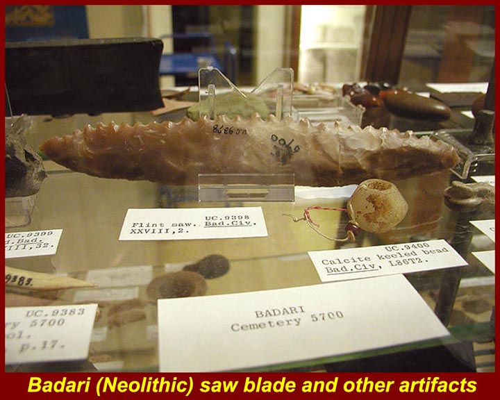
http://www.mmdtkw.org/EGtkw0150BadarianSerratedSaw.jpg
A "Badarian" neolithic serated blade -- usually interpreted as a saw. Badarian neolithic artifacts were first found in a cluster of ancient settlements in the Asyut region of Egypt, about half way between Cairo and Luxor. See http://wysinger.homestead.com/badarians.html for information on the Badarian culture. (Note that the word "culture" when used by archeologists means a recurring assemblage of artifacts from a specific time and place, which are thought to constitute the material culture remains of a particular past human society. Some archaeologists prefer the term Techno-Complex (Technology-Complexes) to differentiate material from sociological culture.)
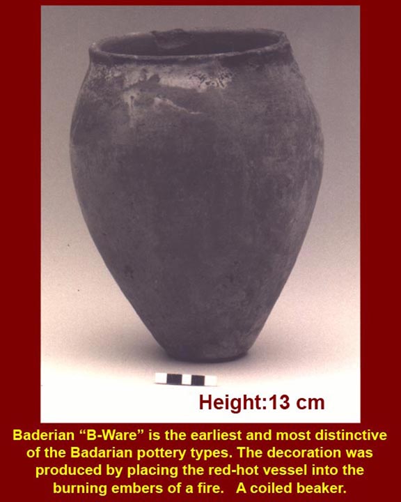
http://www.mmdtkw.org/EGtkw0151CoiledBadarianBeeker.jpg
A coiled badarian beaker, a little more than five inches (13 cm) tall. Early fifith millennium BC.
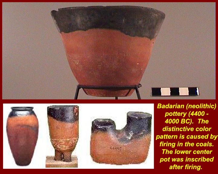
http://www.mmdtkw.org/EGtkw0154Petrie5BadarianPots.jpg
This type of pottery derived its color from the way it was fired -- by placing the coiled pots directly in the coals of the fire. The part below the surface of the coals retained the characteristic red terra-cotta color while the upper parts and interiors were stained by carbon.
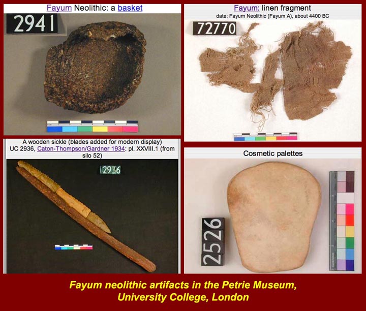
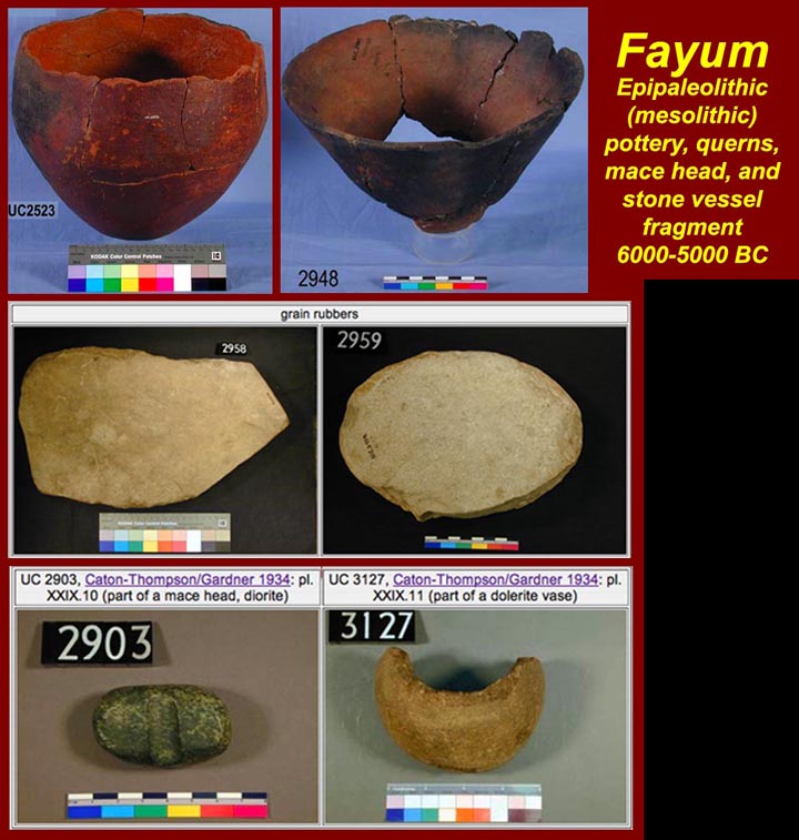
http://www.mmdtkw.org/EGtkw0152Petrie3FayumNeolithic1.jpg
http://www.mmdtkw.org/EGtkw0153Petrie4FayumNeolithic.jpg
Neolithic artifacts and lithics from the Fayum, just south of the Nile Delta. Fifth and early sixth millennium BC.
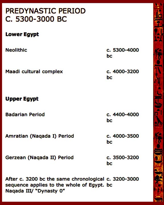
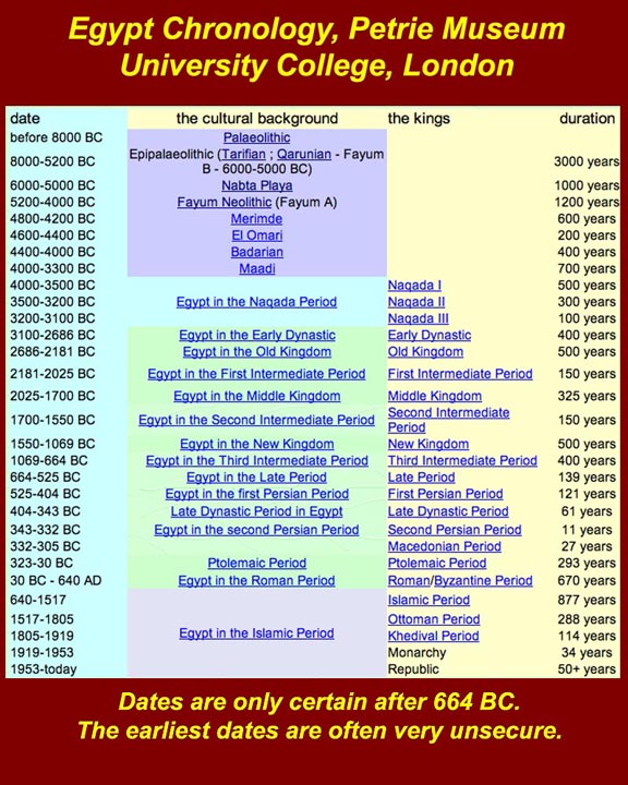
http://www.mmdtkw.org/EGtkw0155PredynasticChron.jpg
http://www.mmdtkw.org/EGtkw0156Petrie0Chron.jpg
Two more chronologies to help separate the periods of Egyptian history. Note that all dates before about 664 BC are tentative, and remember that the (-)lithic periods occurred at different times in different places. That is, Egyptian mesolithic (for example) is not necessarily the same date range as mesolithic in other parts of the world.
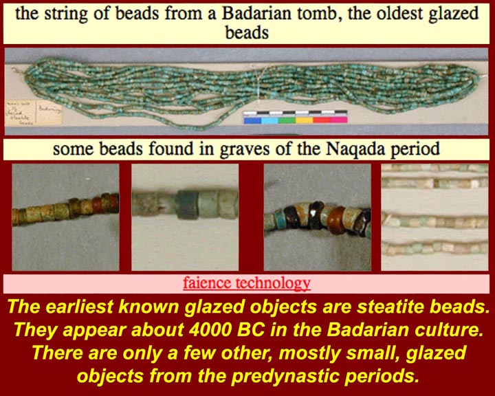
http://www.mmdtkw.org/EGtkw0157GlazedBeads.jpg
The appearance of glazed beads in the Badarian culture around 4000 BC indicates sophisticated firing methods, i.e., forced draft of some kind.
http://www.mmdtkw.org/EGtkw0158HarpoonWhite-CrossBowm.jpg
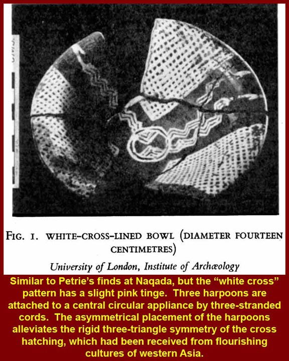
Early Naqada (http://en.wikipedia.org/wiki/Naqada_culture) pottery sometimes had triangular wedges of white cross-hatched glaze. This piece from a nearby site is more sophisticated in that it also shows an asymetrical pattern of three harpoons each trailing three cords. Much has been said about this particular piece and about the artistic esthetic that inspired the asymetrical pattern, but could the artist simply have forgotten to turn his unfired bowl before painting in a transparent glaze to make the third harpoon? Naqada, by the way, is a district about 30 kilometers north of Luxor on the Nile's west bank.
http://www.mmdtkw.org/EGtkw0159Macehead1Naqada.jpg
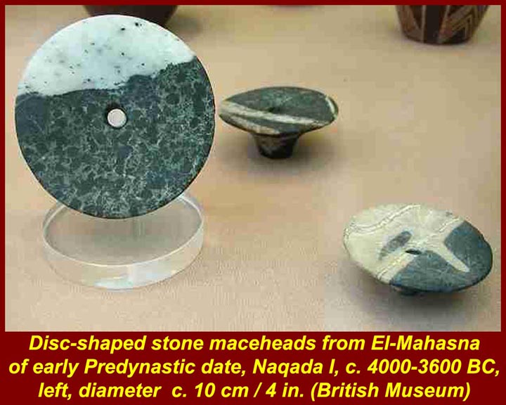
Flattened stone lathe turned mace heads started to appear between 4000 and 3600 BC. They were mounted on handles and used to "smite enemies". See also below, the Narmer and scorpion mace heads which were more pear shaped.
http://www.mmdtkw.org/EGtkw0160Naqada.jpg
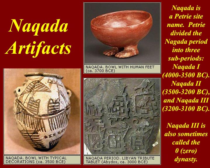
Petrie divided the Naqada sequence int three sub-periods: Naqada I (4000-3500 BC), Naqada II (3500-3200 BC), and Naqada III (3200-3100 BC).
Naqada III is also sometimes called "Dynasty 0", i.e., a time of semi-legendary kings that preceded the first dynasty.
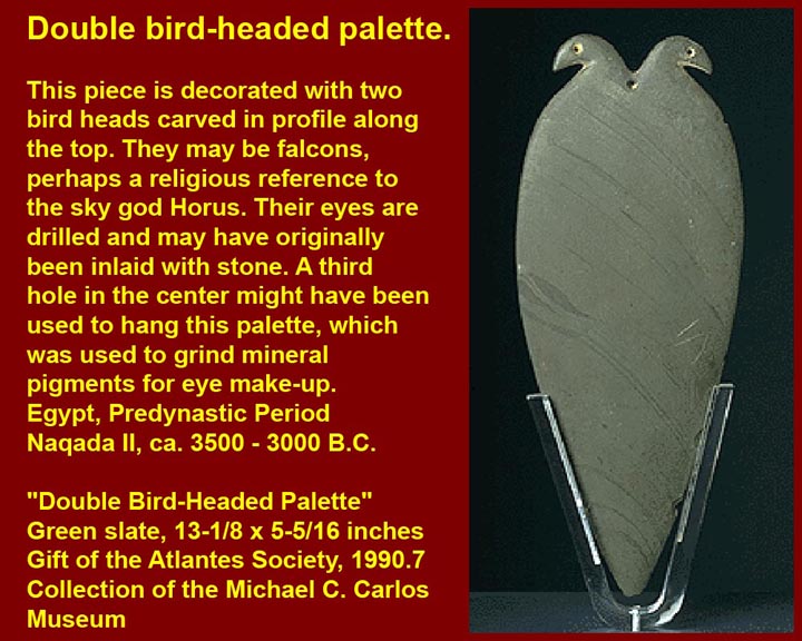
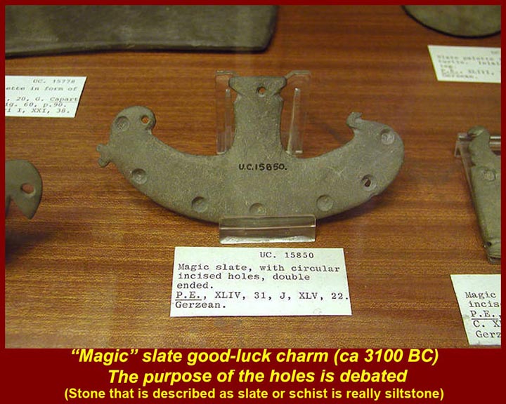
http://www.mmdtkw.org/EGtkw0161CosmeticPalette.jpg
http://www.mmdtkw.org/EGtkw0162PaletteDoubleBirdHead.jpg
http://www.mmdtkw.org/EGtkw0163DecoratedSlateGerzean(Naqada).jpg
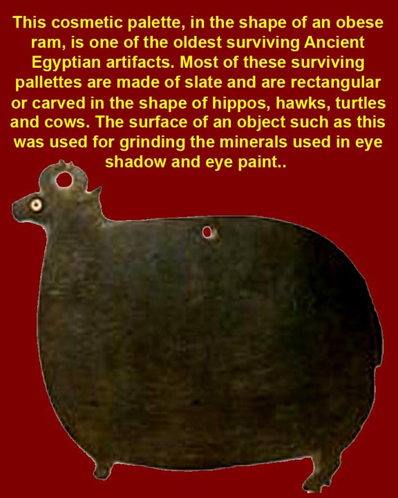
Cosmetic palettes (http://en.wikipedia.org/wiki/Cosmetic_palette) originally were simple rectangular smoothed plates of siltstone or mudstone (not slate of basalt a they are sometimes incorrectly described.) Later, animal shapes were adopted, as seen in the two samples above, and still later complex surface decorations were used. More simple palettes were actually used for grinding and mixing mostly mineral makeup. The most complicated palettes probably either were never actually used or only used once before being ceremonially dedicated at a temple. (See the Narmer palette, below). The use to which the "magic" siltstone object (right) was put is unknown, but the decoration and drilled holes surely had some significance.
Siltstone is a sedimentary rock which has a composition intermediate in grain size between the coarser sandstones and the finer mudstones and shales. Slate is metamorphosized siltstone, mudstone, or shale and basalt is a fine grain plutonic igneous rock.
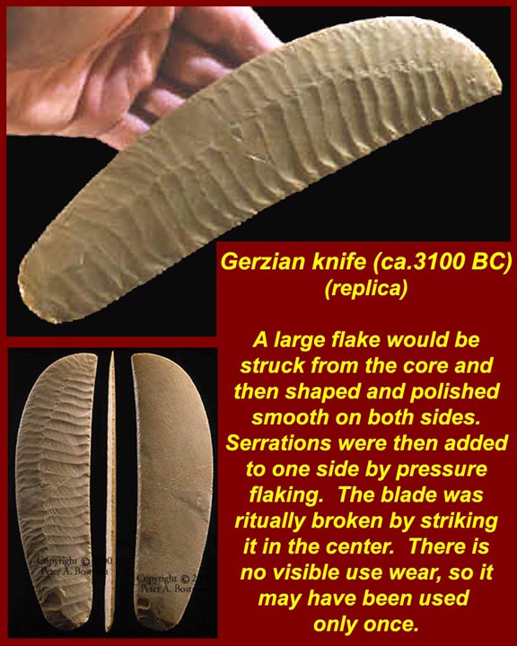
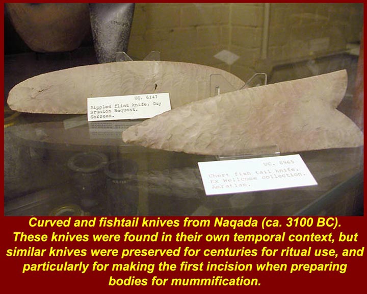
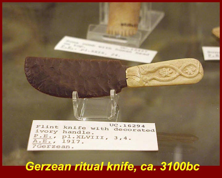
http://www.mmdtkw.org/EGtkw0164KnifeGerzean.jpg
http://www.mmdtkw.org/EGtkw0165KnivesNaqada.jpg
http://www.mmdtkw.org/EGtkw0166KnifeGerziab(Naqada).jpg
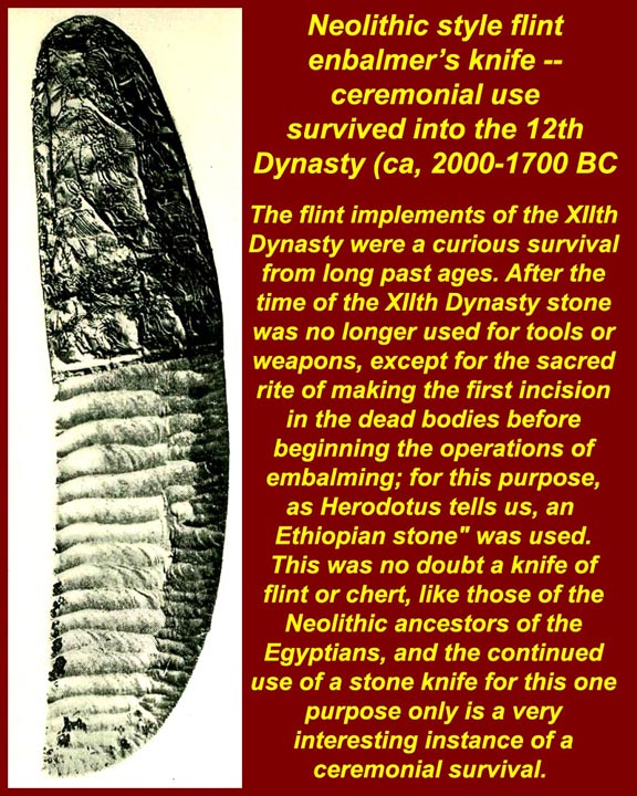
http://www.mmdtkw.org/EGtkw0167KnifeNeolithicEnbalm1.jpg
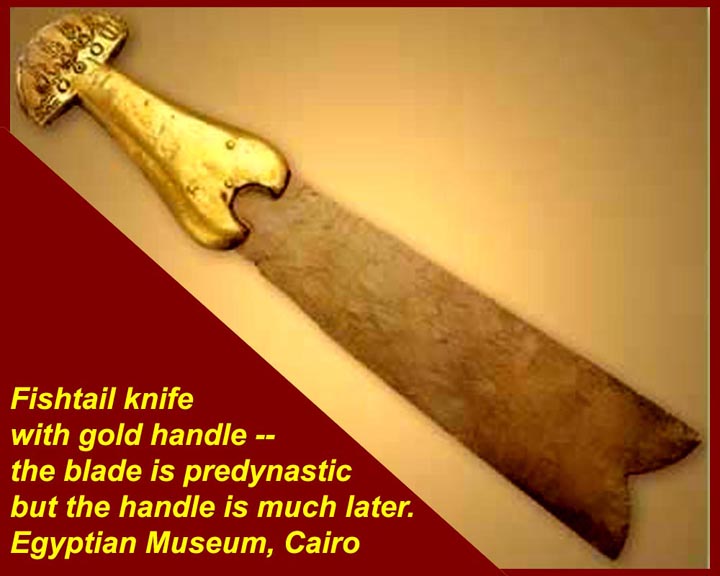
http://www.mmdtkw.org/EGtkw0168KnivesNeolithicFishtail.jpg
Neolithic ceremonial knives were made of large flint flakes. They were highly polished on both sides and then serations in a ripple pattern would be added to only one side by pressure flaking. Knives such as these were used for ceremonial funerary purposes at least into the Middle Kingdom (18th to 21st century BC) although by that time the style was archaic (as were some of the knives). The exact use to which the knives were put in pre-dynastic times is unknown, but in later times the curved knives were used to make the first abdominal cut for evisceration of a body (about the same place and size as an initial apendectomy incision) and the "fishtail" knives were used in the ceremonial "opening of the mouth" of a corpse (so that the person's Ka could re-enter at the apprpopriate time) and may have been used analogously in the "opening of the mouth" of a statue (to recieve a dead person's Ka for "temporary storage") or to ceremonially open a room or temple.
See http://www.touregypt.net/featurestories/open.htm for information on the "opening of the mouth" ritual. The first image shows a knife that was either never used or used only once (no wear) before being ritually broken by being struck in the middle.
See http://homepages.uni-tuebingen.de/alfred.pawlik/Kom-al-Ahmar.pdf for information on neolithic flints.
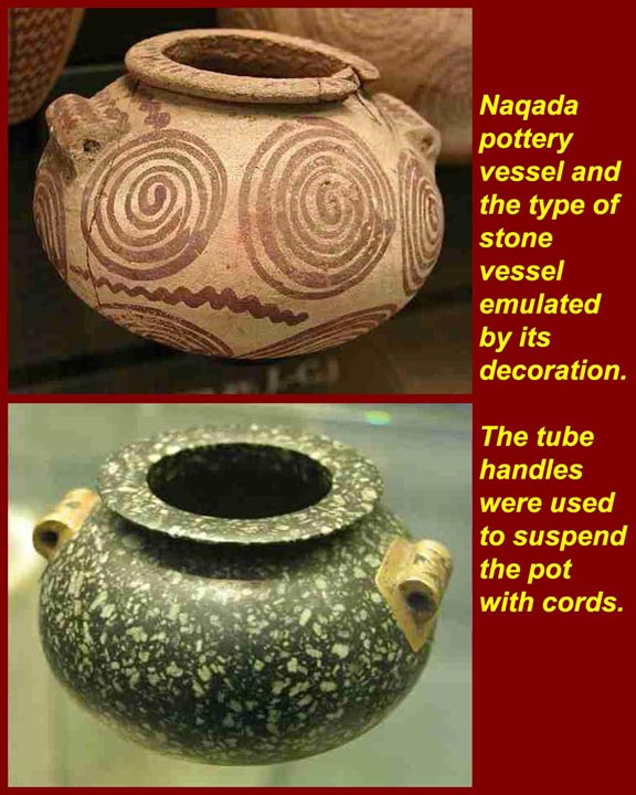
http://www.mmdtkw.org/EGtkw0169NaqadaPot5.jpg
http://www.mmdtkw.org/EGtkw0170NaqadaPot7Bird.jpg
http://www.mmdtkw.org/EGtkw0171NaqadaPot6Stoneware.jpg
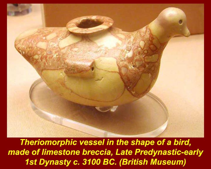
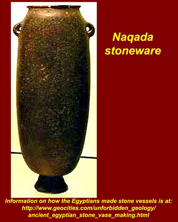
Neolithic predynastic Egyptian artisans produced sophisticated stone as well as pottery vessels. The first decoration of Naqada pottery is thought to be an attempt to emulate patterns seen in stone vessels. Their stone vessels were made using lathes, and drills and deep undercutting was routinely accomplished. The stone pot in the lower half of the first image is particularly noteworthy because of its extremely symetrical shape. It has a rounded bottom but it noetheless stays perfectly balanced and upright. An image of the pot resting on its rounded bottom is at http://www.theglobaleducationproject.org/egypt/pics/saqqara/sqbwl25.jpg. That image is part of an internet site devoted to ancient Egyptian stone technology at
http://www.theglobaleducationproject.org/egypt/articles/stonetech.php.
An internet site that shows how the ancient Egyptians bored and undercut stone vessels is at http://www.reshafim.org.il/ad/egypt/trades/stone_vessels.htm (with additional links to other internet sites).
http://www.mmdtkw.org/EGtkw0172NaqadaPot4Swirl.jpg
http://www.mmdtkw.org/EGtkw0173NaqadaPot1Boat.jpg
http://www.mmdtkw.org/EGtkw0174NaqadaPot2Boat.jpg
http://www.mmdtkw.org/EGtkw0175NaqadaPot3Boat.jpg
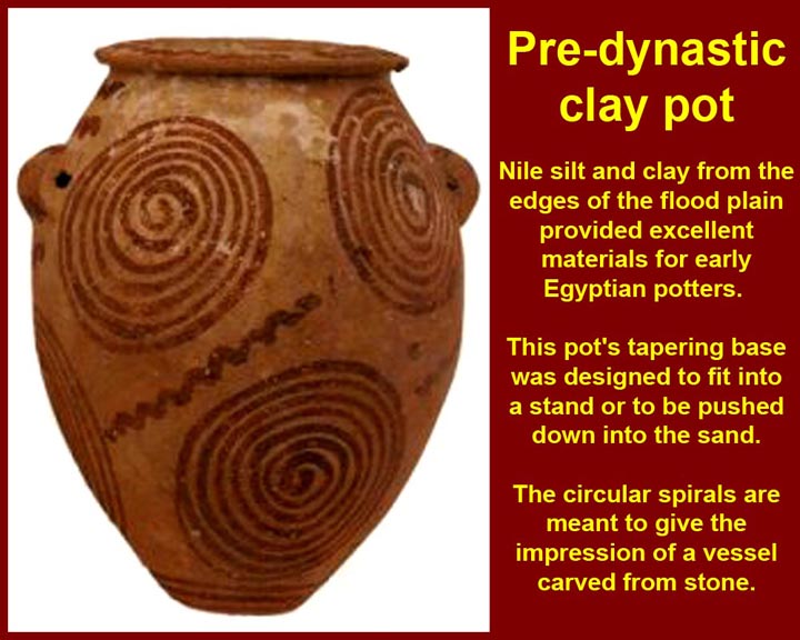
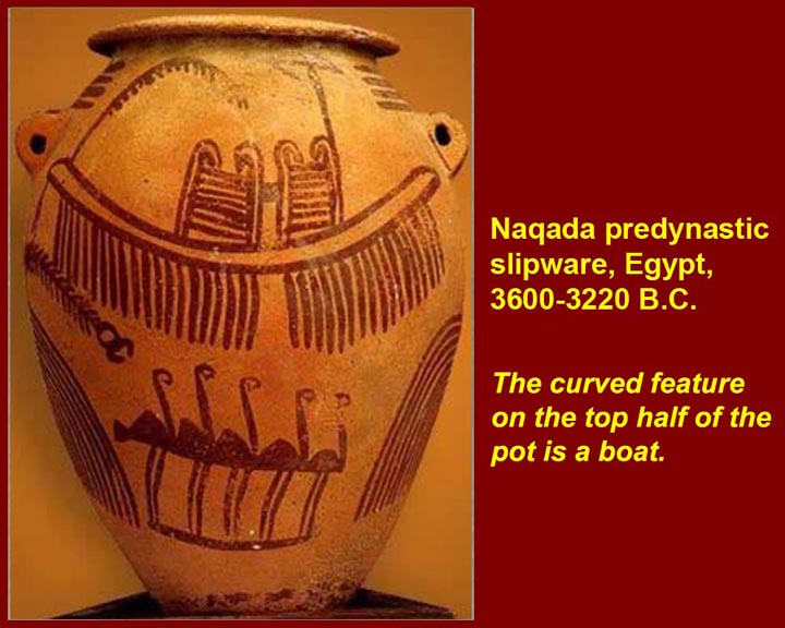
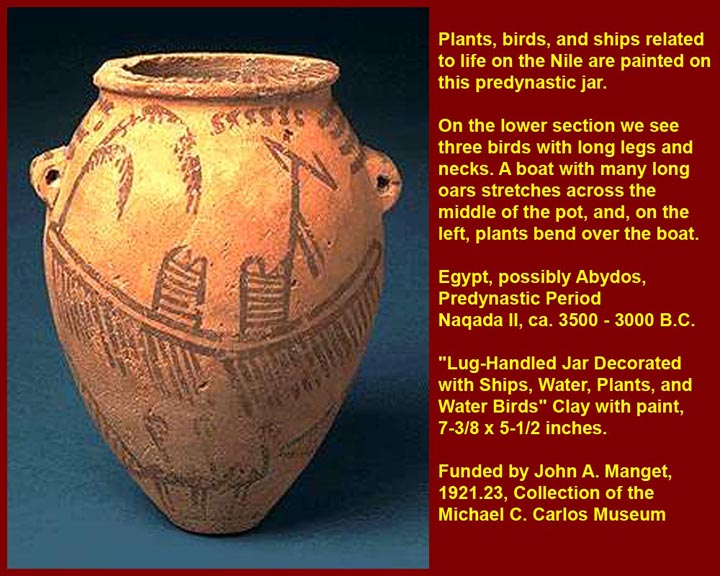
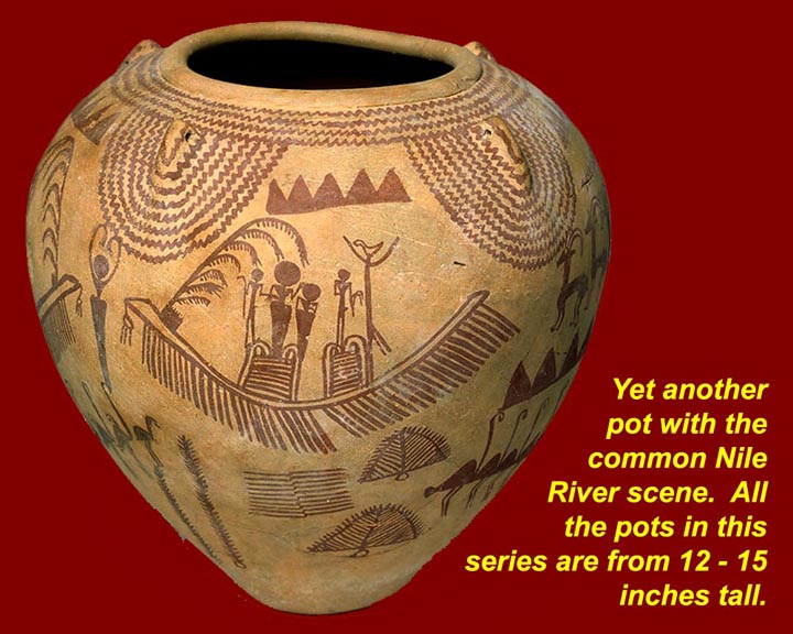
The image on the left shows a Naqada pot with a pattern imitating the appearance of pots made from local stone. In Naqada II and Naqada III it became more common to show boats and Nile River scenes almost to the excusion of other decorative patterns. These scenes show the importance of the Nile river to the lives of the people, and they also may have been precursors of the idea of a voyage (to the Pole Star?) after death. Recent finds well into the Egyptian eastern desert of petroglyphs using almost exactly the same "river motifs" appear to be from the same period as the boats, flamingos, and foliage on these Naqada pots; the animal herders of the eastern desert clearly had contact with the riverine people. The latest period of the Naqada culture coresponds to "proto-dynastic" Egypt -- the so called 000, 00, and 0 dynasties.
http://www.mmdtkw.org/EGtkw0176NaqadaGraveExhibit.jpg
http://www.mmdtkw.org/EGtkw0177Naqada1-3BurialSchema.jpg
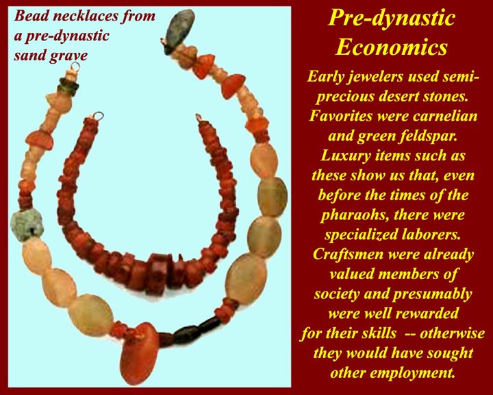
http://www.mmdtkw.org/EGtkw0178PredynGraveNecklaces.jpg
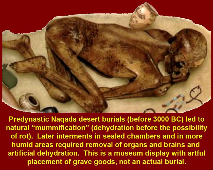
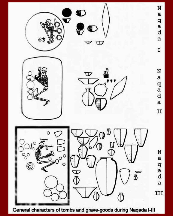
Naqada funeral practices were simple burials near the surface of hot sans. Natural desiccation took place, as shown in the first image (a museum display, not an actual grave). In later times when burials were deeper and chambers were sealed, bodies would rot unless artificial means were used to dessicate the body. We'll go into the gruesome and gory details in a later unit. During the Naqada sequence, bodies were gradually buried in a slightly more extended position and assemblages of grave goods became larger indicating both a spread of wealth (thousands of Naqada graves have been studied) or a reduction in the price of things found in graves. In either case, there is clearly an economic change for the better. The presence of jewelery of semi-precious stones is a wealth marker as well as an indicator that there was enough of a market to support specialized skilled craftesmen.
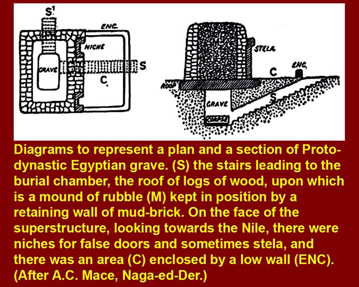
http://www.mmdtkw.org/EGtkw0189EgyptianProtoDynGrave.jpg
By the end of the Naqada predynastic period (Naqada III of "Dynasty 0") a much more sophisticated grave design had developed. Graves were still dug down from the top, but superstructures were added and sometimes decorated. There could also be stairways into the grave used for ceremonial purposes during and after the burial.
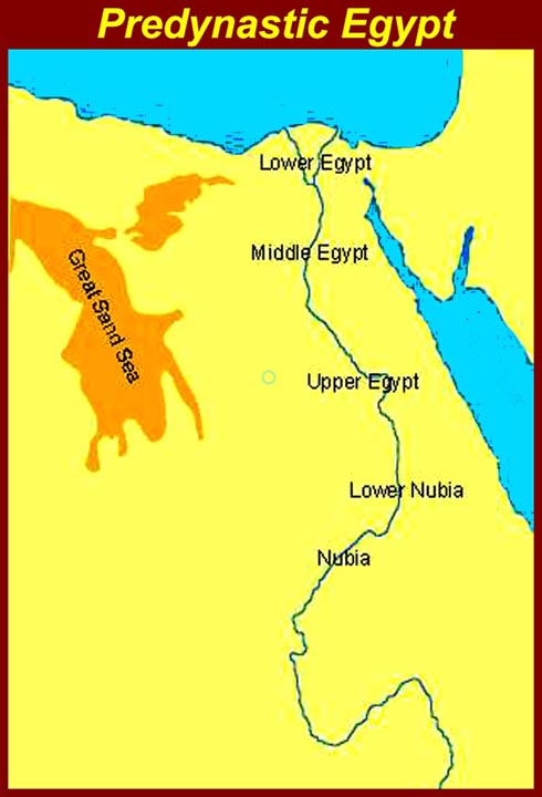
http://www.mmdtkw.org/EGtkw0179MapPredynEgypt.jpg
Up until the some time around the middle of the Naqada period, the Nile Valley was geographically divided and politically diverse. The map shows five geographic regions, but they should not be taken as political divisions. There were actually more and sometimes many more political entities. Toward the end of the Naqada sequence -- during "Dynasty 0" -- unification took place as the Naqada culture spread up and down the valley and completely eclipsed the neolithic cultures of Lower Egypt and Nubia. This process was not completed, however, until about the 4th Dynasty.
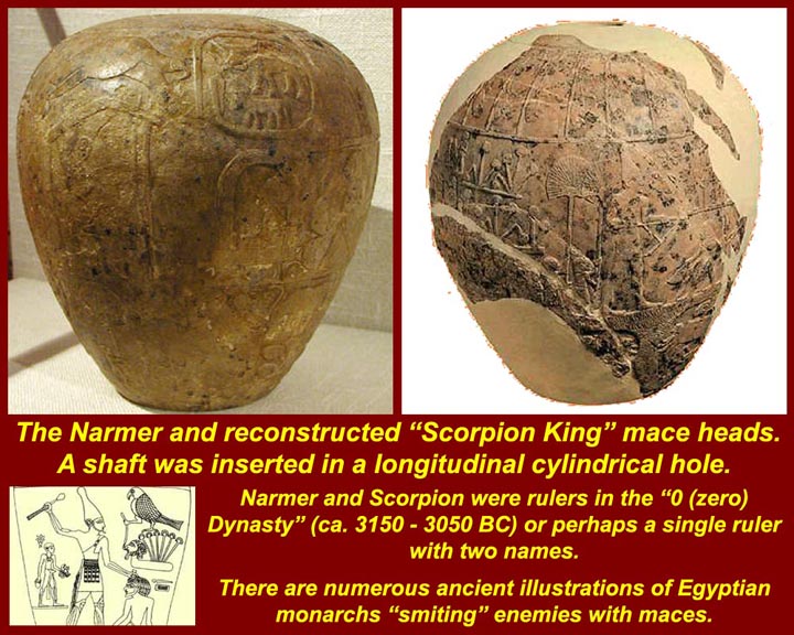
http://www.mmdtkw.org/EGtkw0180MaceheadNarmer.jpg
http://www.mmdtkw.org/EGtkw0181MaceNarmerUnrolled.jpg
http://www.mmdtkw.org/EGtkw0182MaceNarmer.jpg
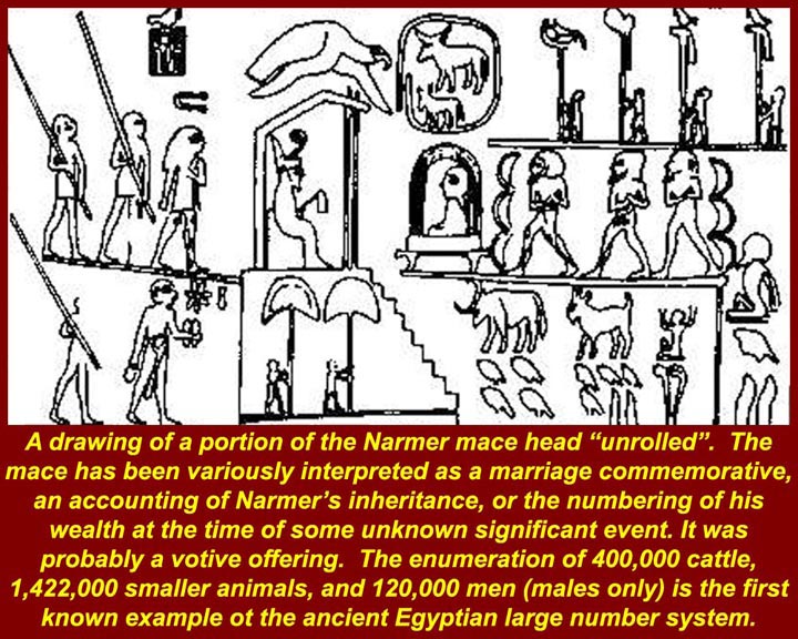
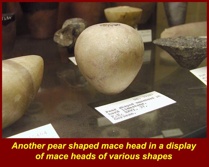
The pear shaped mace heads of Naqada III ("Dynasty 0") could be highly decorated. Both the Narmer (Catfish) and Scorpion mace heads were found in a temple deposite at Hierakonpolis (on the Nile's west bank, just north of Edfu), and the Narmer Palette (see below) was found either in the same deposit or a few feet away. Narmer, Scorpion, Aha, and Menes were either one, two, three or four kings (vast confusion and legendary intermixing of names, attributes, and accomplishments) at the end of Naqada III. There may also have been others. Regardless of the details, Narmer is usually credited with the first unification of Upper and Lower Egypt. The Narmer mace head shows an enthroned king wearing the crown of lower Egypt receiving a woman (a bride?) along with 400 thousand cattle, 1 million 422 thousand smaller animals (sheep?, goats?), and 120 thousand persons (all male). Whether it's all tribute, dowery, or war prizes is not known. For more on Narmer and Hierakonopolis, see http://www.touregypt.net/featurestories/narmer.htm and http://www.archaeology.org/interactive/hierakonpolis/temple.html. For more on the mix-up of names of "Dynasty O", see http://www.touregypt.net/featurestories/menes.htm.
http://www.mmdtkw.org/EGtkw0183NarmerpLowerUpperEgy.jpg
http://www.mmdtkw.org/EGtkw0184NarmerPWhereFound.jpg
http://www.mmdtkw.org/EGtkw0185NarmerLowerEg.jpg
http://www.mmdtkw.org/EGtkw0186PaletteNarmer.jpg
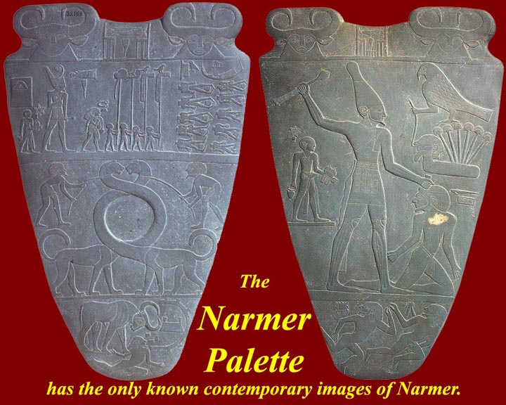
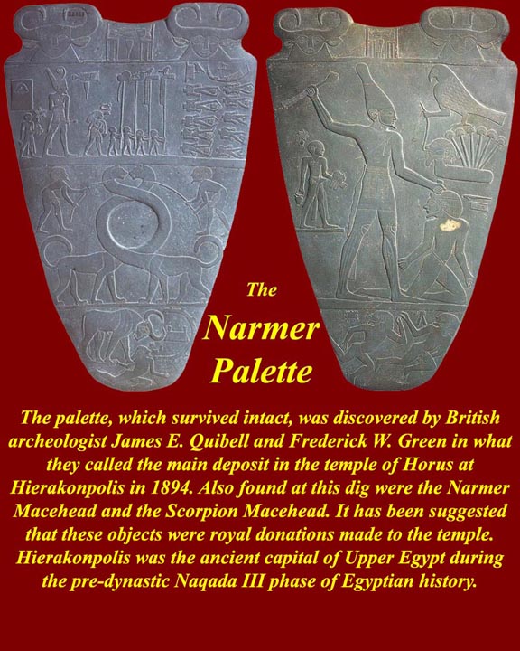
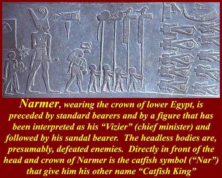
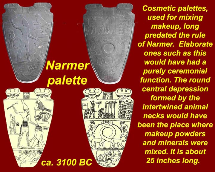
The Narmer Palette is usually considered to be the the most important artifact of Naqada III ("Dynasty 0" or "proto-dynastic" Egypt). Some chronologies list Narmer as the 1st Pharaoh of the 1st Dynasty. Regardless of which list he fits into, he is almost universally recognized as the King who unified Egypt and started the dynastic period. It's all semi mythological anyway, but what we know is that Narmer is listed as a king in some of the earliest Egyptian lists and that this palette, found in 1898, several millennia later, makes Narmer's claim that he was ruler of both upper and lower Egypt. The side with the long twisted animal necks shows him in the crown of Lower Egypt inspecting the bodies of beheaded enemies, and the other side shows wearing the tall crown of Upper Egypt and smiting a conquered foe (above whose head is a raft of Lower Egyptian papyrus.) The palette is, of course, just Narmer's own claim to his own fame, and there's no telling whether he might be exagerating as so many of his Pharoanic successors exagerated their prowess and their conquests. We only have his politician's claim for glory ("Mission accomplished") made way down in southern (Upper) Egypt and far away from his claimed conquest (Lower Egypt) in the north. It's also just minimally possible that the Narmer mace and Narmer Palace were planted years later (but still, of course, way BC) by a sharp Hierakanopolis public relations operative working for the local Chamber of Commerce.
http://www.mmdtkw.org/EGtkw0187NarmerSerekh.jpg
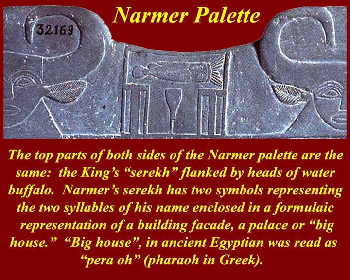
How do we know this is Narmer's Palette? It has his name on both sides of it in a serekh between the water buffalo in the top range of decorations. There are two glyphs that make up Narmer's hieroglyphic name, which is enclosed by a serekh. The serekh, much like the cartouche later on, always denotes royal names.
In Egyptian hieroglyphs, a serekh is a rectangular enclosure representing the niched or gated façade of a palace surmounted by (usually) the Horus falcon, indicating that the text enclosed is a royal name. The serekh was the earliest convention used to set apart the royal name in ancient Egyptian iconography, predating the later and better known cartouche (French for cartridge) by four dynasties and five to seven hundred years. (See http://en.wikipedia.org/wiki/Serekh.)
http://www.mmdtkw.org/EGtkw0187zzNarmerSerekh.jpg
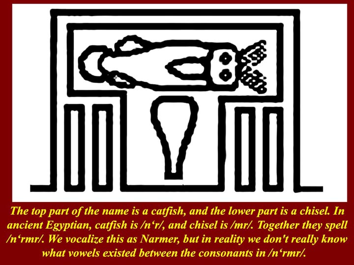
The top part of the name in the serekh is a catfish, and the lower part is a chisel. In ancient Egyptian, catfish is /n‘r/, and chisel is /mr/. Together they spell /n‘rmr/. We vocalize this as Narmer, but in reality we don't really know what vowels existed between the consonants in /n‘rmr/. For that matter, we don't even know whether his name is Narmer or, alternatively perhaps, Mernar. It's all just convention, but at least it's long established convention: the ancient Greeks and Ptolemaic Egyptians (also Greeks) called him Narmer.
http://www.mmdtkw.org/EGtkw0188UnificationMap.jpg
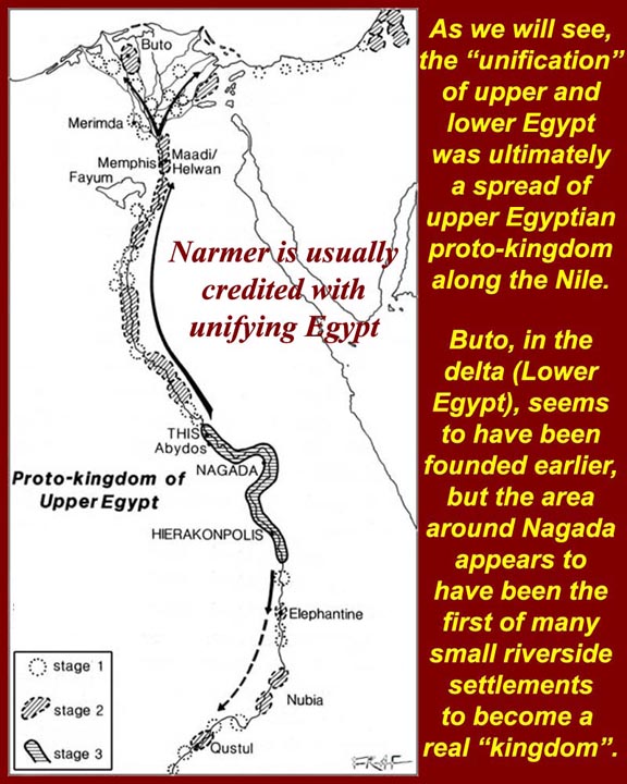
Whoever unified Egypt, it's certainly established that the 1st Dynasty Pharaohs had all of Egypt under their contol by about 3050 BC, and maybe a half century earlier. It's also clear that what had existed in Lower Egypt was overwhelmed by Upper Egypt; the map above tells the story. What is certainly not clear is any idea that a military conquest took place as has been proposed by some interpreters of the Narmer mace and palette. Much more likely is a gradual acceptance by Lower Egypt of Upper Egyptian hegemony. So what's the deal with the palette and mace? Some experts ay it was all allegory -- Narmer not conquering Upper Egypt, but rather controlling chaos. Other savants say that it was Narmerian braggadocio -- and that it set a pattern that reached its peak with Ramesses II and his claim that he won his big battle against the Hittite Empire (under Muwatalli II at the city of Kadesh on the Orontes River, in what is now he Syria (at http://en.wikipedia.org/wiki/Battle_of_Kadesh).
